
Product
-
Weather station
-
Road Weather Station
-
Photovoltaic Inspection
-
Atmospheric monitoring
-
Operating condition monitoring
Recommended article
- How Portable Solar Cell Testers Rapidly Perform PV String I-V Curve Testing
- The price of meteorological monitoring systems varies from 3,900 to 39,800 yuan depending on the number of monitored elements
- Power Quality Measurement Makes Power Grid Harmonic Detection and Data Logging More Efficient
- High-Precision Meteorological observation equipment Aids Field Environmental Monitoring
- How Forest Weather Station Improves Forest Fire Risk Early Warning Capabilities Through Real-Time Data Acquisition
- The Electrical Power Analyzer's four-channel synchronous measurement capability enhances the efficiency of photovoltaic grid-connected testing
Contact us
Shandong Fengtu IOT Technology Co., Ltd
Sales Manager:Ms. Emily Wang
Cel,Whatsapp,Wechat:+86 15898932201
Email:info@fengtutec.com
Add:No. 155 Optoelectronic Industry Accelerator, Gaoxin District, Weifang, Shandong, China
Forest Fire Monitoring System Enables Early Warning of Fire Risk Through Meteorological Data
Article source:Weather station time:2026-04-29 09:48:31 viewed:235times
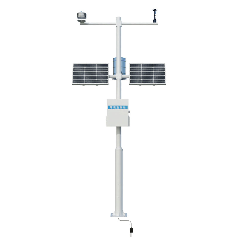
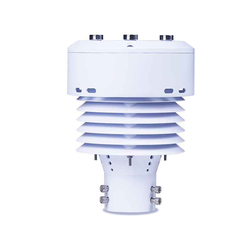
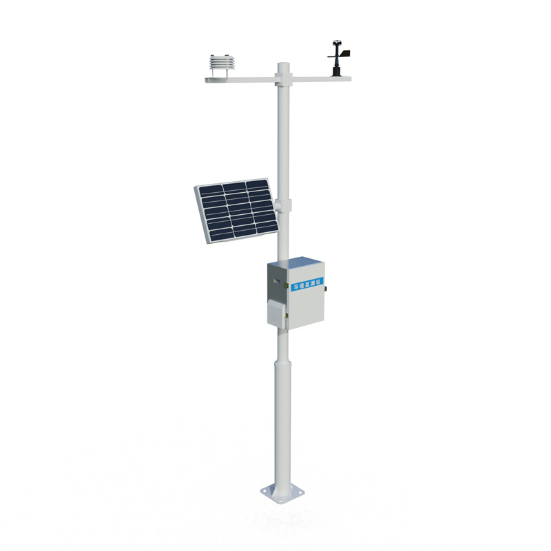
The Forest Fire Monitoring System integrates meteorological sensors—such as those measuring wind speed, wind direction, temperature, humidity, and solar radiation—to collect fire risk factor data in real-time and automatically calculate the current fire risk level. Custom-tailored to meet the practical fire prevention needs of forestry and grassland management, the system facilitates the early warning of fire incidents.
The occurrence of forest fires is closely linked to meteorological conditions. Specific combinations of weather factors—such as high temperatures, low humidity, and strong winds—significantly heighten the combustion risk of flammable materials. The Forest Fire Monitoring System is designed specifically to address this causal relationship; by deploying a network of meteorological sensors throughout forest zones, it continuously collects key parameters—including wind speed, wind direction, air temperature, relative humidity, and solar radiation—thereby providing the foundational data required for assessing fire risk levels. This monitored data is transmitted to a fire prevention command center, where the system automatically calculates the current forest fire risk level while simultaneously transmitting live panoramic video footage from the site, enabling remote surveillance and the timely detection of incipient fire points.
From a technical implementation standpoint, the Forest Fire Monitoring System typically comprises meteorological sensors, data loggers, CCD cameras, image compression processors, wireless communication units, and solar power supply units. The types of data monitored encompass air temperature, air humidity, wind speed, wind direction, precipitation, solar radiation, atmospheric pressure, and—specifically regarding ground-level combustibles—temperature and moisture content; in total, the system monitors 10 distinct parameters. The system is capable of transmitting site-specific meteorological data and imagery to the command center at a frequency of once per hour. Compared to standard meteorological stations, this system features specialized sensors for ground-level combustible moisture and temperature—added specifically to meet forest fire prevention requirements—which directly measure the water content or moisture levels of ground-cover combustibles, thereby providing direct and highly accurate data support for predicting fire risk levels. Furthermore, the system can be integrated with satellite remote sensing platforms, drone formations, and high-altitude ground-based surveillance equipment to construct a multi-layered monitoring network that spans from macro-level overviews to localized details.
In terms of environmental adaptability, the Forest Fire Monitoring System is designed to operate autonomously and unattended in remote wilderness environments for extended periods. The complete unit is engineered to function within an ambient temperature range of -40°C to +50°C; powered by solar energy, its internal battery backup system ensures a continuous power supply for up to 20 consecutive days of overcast weather. The system operates fully automatically, requiring minimal maintenance, and its data acquisition processes strictly adhere to established meteorological operational standards. The communication module supports various wireless networking technologies—including GPRS, CDMA, GSM, and RF—enabling it to adapt to the diverse infrastructure conditions found across different forest regions.
Given the significant variations in fire prevention requirements across different forest areas, the forest fire monitoring system necessitates customized configuration tailored to the specific operational needs of forestry and grassland fire management. Across diverse scenarios—such as nature reserves, state-owned forest farms, or scenic areas—there are distinct requirements regarding sensor types, data acquisition frequencies, transmission methods, and power supply solutions. The system offers flexible configuration of sampling rates, supporting various intervals such as 5 minutes, 30 minutes, or 1 hour, and features an automated data acquisition and reporting capability that is adjustable at minute-level granularity. For data transmission, the system supports public 4G networks; additionally, it can be configured to utilize BeiDou-3 short-message satellite communication, thereby ensuring reliable data backhaul in remote forest regions where public network coverage is poor. Through a centralized platform, the command center can simultaneously display meteorological data, fire risk levels, and real-time local weather conditions for multiple monitoring stations, while also enabling users to query historical data and image evolution records for individual sites. This customized design ensures that the system operates at peak efficiency across a wide range of geographical environments and operational contexts, thereby providing scientific support for forest fire prevention efforts.
This paper addresses:https://fengtuweather.com/industry/932.html
Related products

Related article
-
Smart Tourism Anion Monitoring System
2024-08-26 -
The Significance and Application of Meteorological Observation Stations in Local Weather Monitoring
2025-05-08 -
Ultrasonic Snow Depth Detector Achieving Millimeter-Level Automatic Snow Depth Measurement Using Ultrasonic Ranging Principles
2026-03-19 -
Dust pollution detector to monitor PM2.5
2024-01-24 -
Mobile Weather Stations: Versatile Tools for Meteorological Monitoring
2024-10-15 -
Meteorological instrument All-Weather, Multi-Parameter Meteorological Environment Monitoring
2026-03-12 -
Dust Monitoring Equipment: Comprehensive Monitoring & Control in Construction Projects
2025-06-20 -
Power Quality Measurement Monitoring Multiple Electrical Parameters
2026-03-11